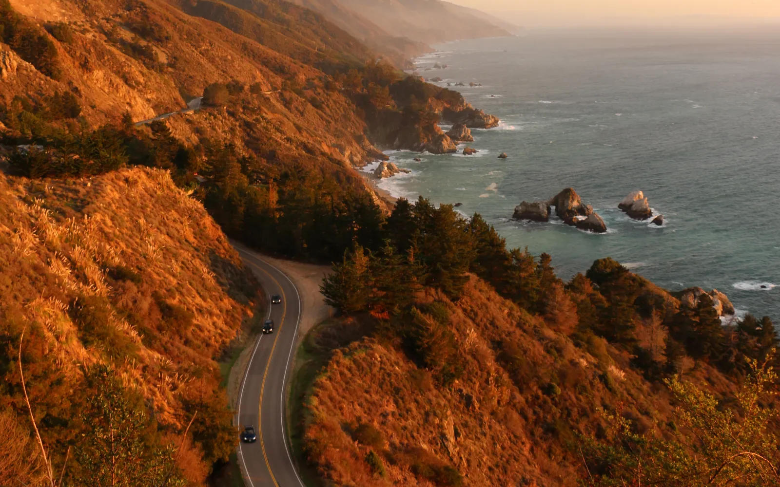
Highway 1 tracing the cliffs above California's Pacific coast

Route guide

California Highway 1: San Francisco to Los Angeles

California Highway 1 between San Francisco and Los Angeles is best treated as a multi-day coastal trip, not the fastest intercity route. A 5–7 day plan gives Big Sur and the Central Coast enough room, but the route is unusually sensitive to landslides, wildfire operations, and emergency closures, so the current Caltrans status must be checked immediately before travel.

See the route snapshot
San Francisco → Los Angeles7-10 daysModerate

Route snapshot

Decide from the constraints first

Core distance
Roughly 750 km / 465 miles depending on the exact coastal routing
Pure drive time
Do not use a fastest-route estimate as the itinerary; coastal stops and temporary closures are the defining planning constraints
Driving side
Right
Road character
Paved highway; closure-prone coastal sections
Road status
Check Caltrans QuickMap / Highway Conditions before the Big Sur leg
Direction
Southbound can simplify access to ocean-side viewpoints, but current access comes first
Parking
Use legal designated pullouts; do not improvise stops on narrow shoulders
Closures
Wildfire, landslide, construction, or emergency operations can change the through-route
Fallback
Keep a U.S. 101 detour strategy and flexible overnight sequence

Fit check

Is this route a good fit?

Use these tradeoffs before booking accommodation into a fixed sequence.

Good for

  • First-time California visitors who value coastal scenery and overnight towns more than the quickest San Francisco–Los Angeles transfer.
  • Travelers comfortable adapting the route when Caltrans closes a coastal section.
  • Couples, families, and photographers who prefer moderate daily mileage with frequent stops.

Think twice if

  • Your schedule cannot tolerate a major detour caused by wildfire, landslide, construction, or emergency operations.
  • You only have one driving day between San Francisco and Los Angeles.
  • You dislike winding cliffside roads, heavy viewpoint traffic, or driving after dark on unfamiliar coastal sections.

Trip length

Minimum, recommended, comfortable

Trip length is treated as a planning choice, not a single magic number.

Minimum

3 days

Possible only as a selective coastal drive with limited stops. Any closure, traffic delay, or long activity can make the schedule brittle.

Recommended

5–7 days

Enough time for Monterey/Carmel, Big Sur, the San Simeon/Cambria area, Santa Barbara, and a relaxed arrival into Los Angeles.

Comfortable

7–10 days

Best for travelers adding hikes, beaches, Hearst Castle, coastal towns, or a buffer day for access changes without turning the trip into repeated long drives.

Driving rhythm

Why map time is not trip time

  1. 01

    Southbound is often the intuitive scenic direction because many Pacific viewpoints sit on the ocean side, but direction should not outweigh current access, lodging sequence, or road closures.

  2. 02

    Build the itinerary around overnight towns rather than a target average speed. Big Sur's value comes from stopping, while pullouts and popular viewpoints can become congested.

  3. 03

    Check Caltrans QuickMap / Highway Conditions shortly before every Big Sur leg. Highway 1 has a history of long emergency closures and can also close temporarily for wildfire or evacuation operations.

Vehicle choice

Match the vehicle to the road

Suitability is separate from rental-company permission. Verify the booking terms for your exact vehicle.

Good fit

Standard car

The route is paved and a normal rental car is appropriate when the road is open. Smaller vehicles can be easier in tight parking and busy coastal towns.

Useful, not required

SUV

Useful for passenger and luggage space, but offers no route-access advantage when Highway 1 is officially closed.

Check restrictions

Campervan / RV

Possible on much of the corridor, but size, parking, campground reservations, rental restrictions, and narrow winding sections deserve separate planning.

Check restrictions

EV

Plan charging around the larger coastal communities and current charger availability rather than assuming every scenic stop has dependable charging.

Core itinerary

A practical planning spine

This is a realistic backbone, not a requirement to complete every attraction listed.

Day 1

San Francisco → Monterey / Carmel

Approx. 190 km / 120 mi with coastal routing · City departure plus moderate coastal day

Priorities

  • Leave San Francisco without rushing
  • Choose one Santa Cruz / Monterey-area stop
  • Confirm Big Sur road status before the next leg

Overnight: Monterey or Carmel

Day 2

Monterey / Carmel → Big Sur or Cambria / San Simeon area

Varies substantially with current access and overnight choice · Primary scenic-driving day; allow most of the day

Priorities

  • Big Sur coastline
  • Designated legal viewpoints
  • One park / short-walk objective if access allows

Optional

  • Bixby Bridge drive-through viewpoint context without illegal stopping
  • Additional park stops only if parking and daylight remain

Overnight: Big Sur, Cambria, or San Simeon depending on current road access

Do not stop, park, make U-turns, or drive excessively slowly at Bixby Bridge where current safety restrictions prohibit these behaviors. Check Caltrans before committing to the through-route.

Day 3

Cambria / San Simeon area → San Luis Obispo / Pismo Beach

Approx. 70–100 km · Low-mileage recovery day

Priorities

  • Hearst Castle only with adequate reservation time
  • Cambria / Morro Bay / SLO choice
  • Avoid overloading the day with every coastal town

Overnight: San Luis Obispo or Pismo Beach

Day 4

San Luis Obispo area → Santa Barbara

Approx. 150 km / 95 mi · Easy coastal transition with town time

Priorities

  • One Central Coast stop
  • Santa Barbara arrival with daylight
  • Refuel / recharge before final leg

Overnight: Santa Barbara

Day 5

Santa Barbara → Los Angeles

Approx. 150–190 km depending on route and destination · Coastal finish with metropolitan traffic margin

Priorities

  • Ventura or Malibu only if timing works
  • Allow extra time for Los Angeles traffic
  • Avoid tying a flight departure closely to the drive

Overnight: Los Angeles

Season decision

Choose the tradeoff, not just the month

Conditions can change faster than an editorial page. Recheck official sources before departure.

April–October

Primary planning window

Longer daylight helps, but fog, wildfire, construction, traffic, and emergency closures can still affect Highway 1. Always check Caltrans immediately before the Big Sur segment.

November–March

Possible with greater access uncertainty

Storm-driven landslides and road damage are an important planning risk. Keep detour options and flexible accommodation in the plan.

Any season during an active closure

Re-route rather than force the classic through-drive

Treat official closures as a hard constraint. Use U.S. 101 or another legal detour and preserve selected coastal sections as out-and-back visits only when authorities say they are accessible.

FAQ

Questions that change the plan

Is Highway 1 currently open through Big Sur?

Do not rely on a static answer. Highway 1 has reopened and closed in different sections at different times; check Caltrans QuickMap or Highway Conditions immediately before travel and again before entering the Big Sur segment.

How many days should I allow from San Francisco to Los Angeles?

Three days is compressed. Five to seven days is a better first-time range because it leaves time for Big Sur, coastal towns, legal viewpoints, and access changes without turning the trip into a transfer race.

Should I drive southbound or northbound?

Southbound is attractive because many ocean-side pullouts are on the right, but direction is secondary to current road access, accommodation availability, and your broader California itinerary.

What happens if Big Sur is closed?

Do not attempt to bypass a closure. Re-plan around the official detour, usually using inland highways such as U.S. 101, and visit accessible coastal sections separately only when authorities confirm they are open.

Compare the road type

Put this route back in context.

Do you want easy ocean access, or are you comfortable sharing narrow roads with viewpoints, towns, and changing weather?

See the coastal comparison

Official sources

Verify the changing parts

Operational facts were reviewed on 2026-09-03. Road conditions, access, and winter requirements can change sooner.

Packing context

Categories that match the road

These are planning categories, not a shopping list. Choose equipment for the actual forecast, activity and vehicle plan.

Light wind / rain layer

Coastal fog, wind and temperature shifts can make viewpoint stops much cooler than inland conditions.

Compact day bag

Keep water, layer and valuables together when moving between viewpoints, towns and short walks.

Sun protection

Exposed coastal stops can still have strong sun even when marine fog is nearby.

Phone power

Navigation, road-status checks and photography can drain a phone during a long scenic day.

RoadTrip Guide is part of Horizon Outdoor. No product or affiliate link is required for this guidance to be useful.