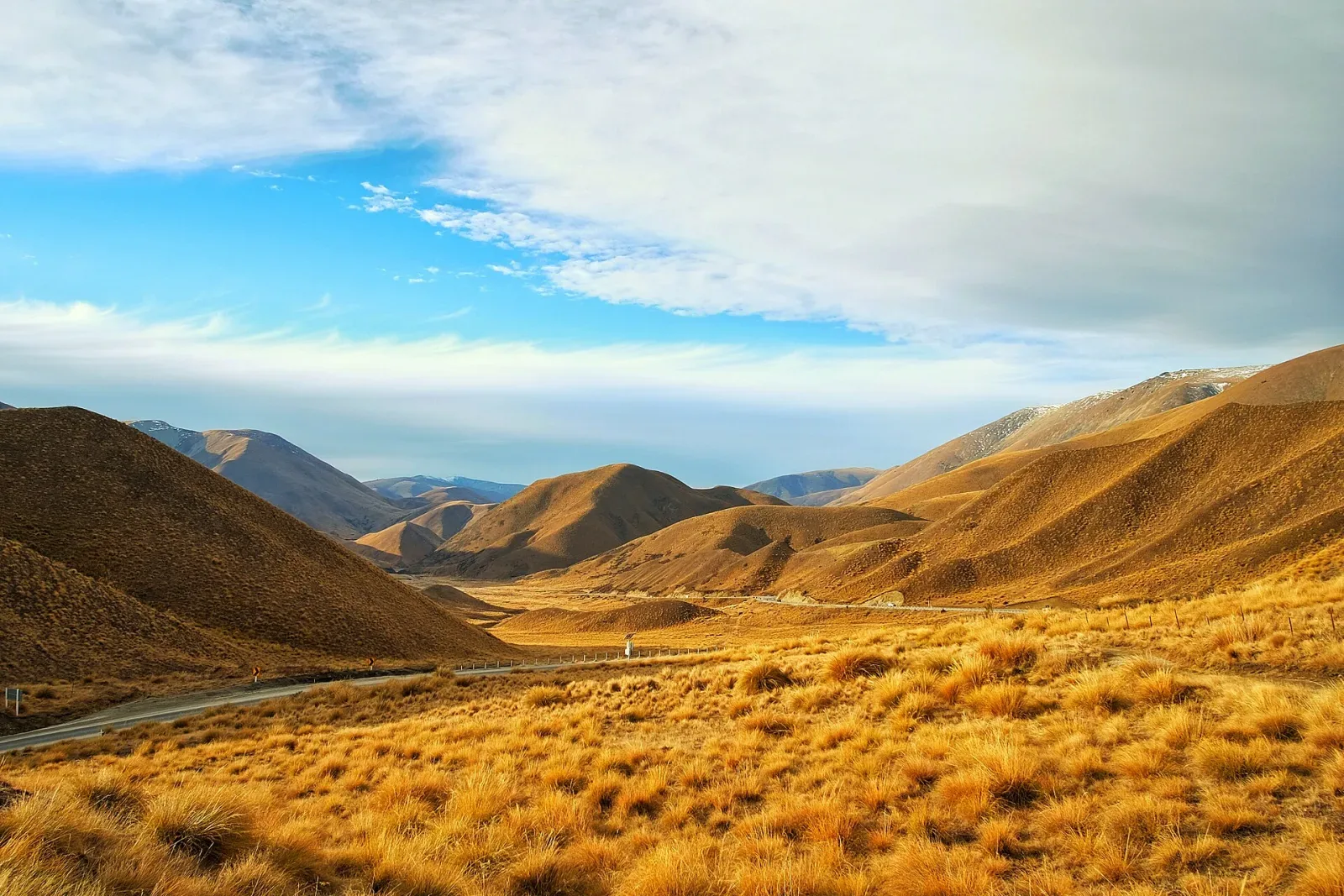
A South Island road running between golden grass and alpine ridges

Route guide

New Zealand South Island Grand Loop

A South Island grand loop rewards time more than mileage. New Zealand roads can be narrow, winding, steep, and slower than their map distance suggests, so a 14-day loop is a practical first-time minimum and 18–21 days is a stronger fit if the West Coast, Queenstown, Aoraki / Mount Cook, walks, and weather flexibility all matter.

See the route snapshot
Christchurch → Christchurch14-21 daysModerate

Route snapshot

Decide from the constraints first

Core distance
Approx. 2,000–2,500 km for a broad Christchurch–West Coast–Queenstown–Aoraki / Mount Cook loop before optional detours
Pure drive time
Do not total map hours and treat them as sightseeing days; NZTA warns that travel times are often longer than visitors expect
Driving side
Left
Road character
Paved highways; optional gravel approaches
Driving side
Left; overseas visitors should deliberately reset habits at every junction and after stops
Travel time
Often longer than map distance suggests because many roads are narrow, winding, or steep
Live conditions
Use NZTA Journey Planner for state-highway incidents, roadworks, closures, and travel times
Fatigue
Do not use a long driving day to compensate for delays or jet lag
Route scope
Add Fiordland or the far north only by adding days, not by compressing the core loop

Fit check

Is this route a good fit?

Use these tradeoffs before booking accommodation into a fixed sequence.

Good for

  • First-time New Zealand visitors who want one self-drive framework combining alpine passes, the West Coast, lakes, and high-country scenery.
  • Travelers comfortable driving on the left and allowing more time than a simple map estimate suggests.
  • Families, couples, and outdoor travelers who prefer moderate daily distances with walks and scenic stops outside the vehicle.

Think twice if

  • You have fewer than 10 days but still expect a full-island loop plus Milford Sound, multiple long hikes, and several rest days.
  • You plan to drive immediately after a long-haul flight without first managing fatigue and adapting to left-side driving.
  • Your accommodation sequence cannot tolerate weather, roadworks, closures, or a longer alternate route when a state highway is disrupted.

Trip length

Minimum, recommended, comfortable

Trip length is treated as a planning choice, not a single magic number.

Minimum

10 days

A selective loop for experienced planners who accept several transfer-heavy days and skip major detours. It leaves limited resilience for weather, road events, or longer walks.

Recommended

14 days

A practical first-time loop with room for the West Coast, Wānaka / Queenstown, Aoraki / Mount Cook, and Christchurch without making every scenic day a long transfer.

Comfortable

18–21 days

Best for travelers adding Fiordland, longer hikes, slower town days, wildlife stops, or meaningful buffers when weather or state-highway conditions alter the route.

Driving rhythm

Why map time is not trip time

  1. 01

    NZTA explicitly warns overseas visitors that distances can look short while roads are narrow, winding, mountainous, or steep. Build days around realistic road character rather than an average-speed target.

  2. 02

    Use the NZTA Journey Planner before major legs. Its route suggestions are indicative and can become unsuitable when closures, roadworks, incidents, or weather change state-highway access.

  3. 03

    Treat fatigue as an itinerary constraint. NZTA advises overseas visitors to rest after arrival and to stop when tired; a scenic itinerary should not rely on recovering lost time with a late drive.

Vehicle choice

Match the vehicle to the road

Suitability is separate from rental-company permission. Verify the booking terms for your exact vehicle.

Good fit

Standard car

Suitable for the core sealed state-highway loop. Choose a vehicle you can place confidently on narrow roads and verify any rental restrictions before optional gravel access roads.

Useful, not required

SUV / AWD

Useful for luggage and comfort, but not a substitute for current road conditions, winter equipment, rental permission, or conservative driving on alpine routes.

Check restrictions

Campervan

Common for South Island travel, but size changes braking, cornering, parking, and wind exposure. Check camping rules, holiday-park availability, and rental-company restrictions separately.

Check restrictions

EV

NZTA Journey Planner includes public charging locations, but charging should be planned around the actual route, operator status, weather, and remote-section alternatives rather than assumed from distance alone.

Core itinerary

A practical planning spine

This is a realistic backbone, not a requirement to complete every attraction listed.

Day 1

Christchurch → Christchurch

Local · Arrival, recovery, and left-side-driving orientation day

Priorities

  • Rest after long-haul travel
  • Review NZTA visitor-driving guidance
  • Collect rental vehicle only when alert enough to drive

Overnight: Christchurch

Day 2

Christchurch → West Coast / Greymouth area

Approx. 240 km via Arthur’s Pass · Mountain-pass day with frequent weather and scenery stops

Priorities

  • Arthur’s Pass corridor
  • One short walk if weather and daylight allow
  • Check SH73 conditions before departure

Overnight: Greymouth or Hokitika

Day 3

Greymouth / Hokitika → Glacier country

Approx. 135–175 km depending on start and base · Shorter West Coast day with high stop density

Priorities

  • West Coast landscape stop
  • Glacier-region access check
  • Keep walks conditional on weather and local safety guidance

Overnight: Franz Josef / Waiau or Fox Glacier area

Day 4

Glacier country → Wānaka

Approx. 260–290 km via Haast Pass · Long scenic transfer where road and weather conditions control timing

Priorities

  • Haast Pass corridor
  • Fuel and food planning
  • Arrive Wānaka before fatigue becomes the limiting factor

Overnight: Wānaka

Day 5

Wānaka → Queenstown

Approx. 70–115 km depending on Crown Range or alternate route · Short-distance day with a meaningful route-choice decision

Priorities

  • Choose route based on weather and driver confidence
  • Wānaka morning or short walk
  • Queenstown arrival without overloading the day

Overnight: Queenstown

Tourism New Zealand describes the Crown Range as the shortest but more challenging option; use an alternate route when current conditions or driver confidence make that the safer choice.

Day 6

Queenstown → Queenstown

Local · No-transfer activity / recovery day

Priorities

  • Choose one major Queenstown objective
  • Avoid stacking a long excursion with a late onward drive

Overnight: Queenstown

Day 7

Queenstown → Aoraki / Mount Cook or Tekapo area

Approx. 260–330 km depending on overnight base · High-country transfer with several tempting stops

Priorities

  • Allow time through Central Otago / Mackenzie Country
  • Check weather before committing to alpine walks
  • Arrive with daylight margin

Overnight: Aoraki / Mount Cook Village or Lake Tekapo area

Day 8

Aoraki / Mount Cook or Tekapo area → Christchurch

Approx. 225–330 km depending on start · Return leg; keep onward-flight timing separate from the drive

Priorities

  • One morning scenic objective if conditions allow
  • Use NZTA Journey Planner before departure
  • Return Christchurch with contingency margin

Overnight: Christchurch

This eight-day spine describes the major driving sequence, not the recommended total trip length. Add regional days and buffers to reach the 14-day recommended plan.

Season decision

Choose the tradeoff, not just the month

Conditions can change faster than an editorial page. Recheck official sources before departure.

December–March

Simplest first-time loop window

Longer daylight helps scenic stops, but peak-season accommodation, holiday traffic, roadworks, strong weather systems, and popular trail parking still require advance planning and daily condition checks.

October–November / April

Good shoulder-season option for flexible travelers

Lower crowds can help, but shorter daylight and more variable alpine weather make conservative driving days and flexible activities more important.

May–September

Winter-capable itinerary, not the default first-time loop

Snow, ice, alpine-pass conditions, shorter daylight, and weather closures can materially change the route. Check NZTA conditions and vehicle/rental winter requirements before each affected leg.

FAQ

Questions that change the plan

How many days do I need for a South Island road trip?

Ten days can cover a selective loop, but 14 days is a more realistic first-time minimum for the West Coast, Wānaka / Queenstown, Aoraki / Mount Cook, and Christchurch. Eighteen to 21 days is better if you add Fiordland, longer walks, or real weather buffers.

Why are New Zealand driving times longer than expected?

NZTA warns visitors that many roads are narrow, winding, mountainous, or steep, often with one lane in each direction. Scenic stops, roadworks, weather, and slower vehicles add more time beyond the basic road estimate.

Should I drive straight after landing in New Zealand?

Do not build the itinerary around that assumption. NZTA specifically warns about fatigue and advises visitors to rest after arrival, so the safer plan is to recover before taking on unfamiliar left-side roads or a long transfer.

Can I rely on Google Maps for South Island road conditions?

Use it only as one planning input. NZTA states that its own Journey Planner route suggestions can become unsuitable when closures or unplanned events occur, so current state-highway conditions, incidents, roadworks, and delays should be checked before major legs.

Compare the road type

Put this route back in context.

Will a complete circuit leave enough time outside the car, or would a shorter regional loop make the trip better?

See the island loops comparison

Official sources

Verify the changing parts

Operational facts were reviewed on 2026-09-03. Road conditions, access, and winter requirements can change sooner.

Packing context

Categories that match the road

These are planning categories, not a shopping list. Choose equipment for the actual forecast, activity and vehicle plan.

Waterproof shell

West Coast rain, alpine weather and exposed viewpoints can occur within the same itinerary.

Warm mid-layer

Mountain passes and early/late-day stops can be cool even in the main travel season.

Daypack

A practical bridge between driving days and frequent short walks or longer hikes.

Sun protection

Outdoor stops and long daylight can mean extended sun exposure.

Phone power

Navigation and current-condition checks matter on long rural legs.

RoadTrip Guide is part of Horizon Outdoor. No product or affiliate link is required for this guidance to be useful.