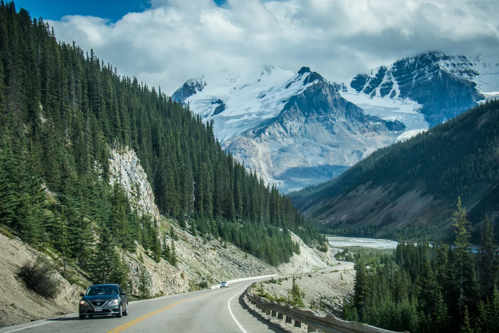
The Icefields Parkway leading toward peaks in the Canadian Rockies

Route guide

Canadian Rockies: Banff to Jasper via the Icefields Parkway

The Icefields Parkway is short on a map but should not be planned like a transfer road. The 232 km Lake Louise–Jasper corridor needs at least a full day for a through-drive with meaningful stops; a five-to-seven-day Banff–Jasper trip is a better fit if hiking, weather flexibility, and time in both park towns matter.

See the route snapshot
Banff / Lake Louise → Jasper5-7 daysModerate

Route snapshot

Decide from the constraints first

Core distance
232 km Lake Louise–Jasper; about 290 km Banff–Jasper
Pure drive time
Parks Canada advises 3–4 hours for the Parkway before sightseeing stops
Driving side
Right
Road character
Paved mountain highway with seasonal conditions
Road
Paved mountain highway; live conditions can change quickly
Fuel
Limited on-route fuel in the visitor season; none along the Parkway in winter
Cell service
Do not rely on coverage along the Parkway
Entry
A valid national park entry pass is required
Live conditions
Use 511 Alberta and current Parks Canada notices, not only consumer map apps

Fit check

Is this route a good fit?

Use these tradeoffs before booking accommodation into a fixed sequence.

Good for

  • First-time Canadian Rockies visitors who want one continuous mountain corridor rather than repeated day trips.
  • Families and photographers who value frequent scenic stops more than high daily mileage.
  • Travelers comfortable planning around limited services and weak mobile coverage between the park towns.

Think twice if

  • You only have one short day and also expect to hike, visit lakes, and stop at most viewpoints.
  • You need reliable mobile service throughout the driving day.
  • You are uncomfortable with winter mountain driving or cannot meet current tire/chain requirements in snowy periods.

Trip length

Minimum, recommended, comfortable

Trip length is treated as a planning choice, not a single magic number.

Minimum

3 days

A compressed point-to-point trip. Keep walks short and accept that weather or parking can remove stops from the plan.

Recommended

5 days

Enough time for Banff/Lake Louise, a full Parkway travel day, and Jasper without turning every day into a long driving day.

Comfortable

7 days

Best for travelers who want trail time, slower mornings, wildlife buffers, and room to adapt to mountain weather.

Driving rhythm

Why map time is not trip time

  1. 01

    Treat the Parkway as the day’s destination. Parks Canada’s 3–4 hour drive estimate excludes the time most visitors actually want for viewpoints, meals, washrooms, short walks, parking, and weather delays.

  2. 02

    Fill the tank before the remote section. Parks Canada notes only one gas station along the 232 km Parkway in the main visitor season and no fuel/services along the route in winter.

  3. 03

    Do not depend on mobile data for navigation or changes of plan. Parks Canada states that cell coverage is unavailable along the Icefields Parkway, with service mainly at the ends.

Vehicle choice

Match the vehicle to the road

Suitability is separate from rental-company permission. Verify the booking terms for your exact vehicle.

Good fit

Standard car

The main Parkway is paved. In snow/ice periods, current winter-equipment rules and road conditions matter more than vehicle size.

Useful, not required

SUV / AWD

Useful for comfort and poor weather, but AWD does not replace proper tires, conservative driving, or checking 511 Alberta.

Check restrictions

Campervan / RV

Common on the corridor, but travelers should verify campground availability, vehicle-specific rental rules, and any current size or seasonal restrictions before booking.

Check restrictions

EV

Plan charging around Banff/Lake Louise/Jasper and current infrastructure rather than assuming continuous charging availability on the Parkway itself.

Core itinerary

A practical planning spine

This is a realistic backbone, not a requirement to complete every attraction listed.

Day 1

Calgary or Banff gateway → Banff

Varies by arrival point · Arrival and setup day

Priorities

  • Collect park/current road information
  • Settle into Banff
  • Keep the first evening flexible

Overnight: Banff

Day 2

Banff → Lake Louise area

Approx. 60 km direct · Short driving day with timed-access planning

Priorities

  • Banff/Lake Louise corridor
  • One major lake or trail objective
  • Confirm next-day Parkway conditions

Optional

  • Secondary viewpoints only if parking and time remain

Overnight: Lake Louise area or Banff

Moraine Lake access is managed separately and personal vehicles are not permitted on Moraine Lake Road; verify current transit/shuttle rules.

Day 3

Lake Louise → Jasper

Approx. 232 km · Full road-trip day; do not treat as a 3–4 hour transfer

Priorities

  • Peyto Lake / Bow Summit area
  • Columbia Icefield area
  • Athabasca or Sunwapta Falls based on time and access

Optional

  • Short additional viewpoints
  • Longer walk only if it does not compromise daylight or weather margin

Overnight: Jasper

Fill fuel before departure, carry offline navigation, and check 511 Alberta plus Parks Canada notices before committing to the corridor.

Day 4

Jasper → Jasper

Local · Low-mileage park day

Priorities

  • Choose one Jasper-area objective
  • Leave room for wildfire/closure or weather-related substitutions

Overnight: Jasper

Day 5

Jasper → Departure gateway or buffer night

Varies · Buffer / onward travel

Priorities

  • Use as recovery time if earlier weather changed the itinerary
  • Recheck Highway 16 / onward road conditions

Overnight: Depends on onward route

Season decision

Choose the tradeoff, not just the month

Conditions can change faster than an editorial page. Recheck official sources before departure.

June–September

Primary first-time window

Most services are available, but parking pressure and accommodation demand are higher. Snow can still occur in mountain weather and conditions should be checked close to travel.

May / October

Shoulder season with more variability

Expect fewer services, colder conditions, and a higher chance that snow changes trails or road conditions. Build more schedule flexibility.

November–March

Winter driving trip, not a default first-time plan

Parks Canada requires snow tires or chains during the defined winter period and notes no services along the Parkway in winter. Avalanche control, weather, and closures can change the day quickly.

FAQ

Questions that change the plan

Can I drive the Icefields Parkway in one day?

Yes for a through-drive, but the road should usually consume most of that day. Parks Canada advises 3–4 hours of driving before sightseeing, so a realistic plan needs additional time for viewpoints, food, washrooms, parking, and weather.

Do I need AWD?

Not simply because the main Parkway is mountainous: it is paved. In winter or snowy periods, proper tires/chains, road conditions, driver experience, and rental-company rules matter more than treating AWD as a substitute for preparation.

Is there cell service on the route?

Plan as if there is no dependable service between the ends of the corridor. Download maps and important booking information before leaving Banff/Lake Louise or Jasper.

Is the Parkway open in winter?

It is generally open year-round but can close for extreme weather, avalanche risk, or safety operations. Check 511 Alberta and Parks Canada immediately before departure rather than assuming a planned winter drive is available.

Compare the road type

Put this route back in context.

How much of each day should be driving, and how much should remain for trails, viewpoints, and wildlife-safe stops?

See the mountain parks comparison

Official sources

Verify the changing parts

Operational facts were reviewed on 2026-09-03. Road conditions, access, and winter requirements can change sooner.

Packing context

Categories that match the road

These are planning categories, not a shopping list. Choose equipment for the actual forecast, activity and vehicle plan.

Insulating layer

Mountain temperatures can change rapidly with elevation, shade and weather.

Rain shell

A compact waterproof layer keeps short roadside and trail stops viable when weather changes.

Daypack

Carry water, food, layers and wildlife-safe essentials without repeatedly unpacking the vehicle.

Water and snacks

Services are limited along the Icefields Parkway and should not be treated as continuously available.

Backup phone power

Cell coverage is limited, but offline maps, booking details and photos still consume power.

RoadTrip Guide is part of Horizon Outdoor. No product or affiliate link is required for this guidance to be useful.